


Undertaking a civil project is no small feat. It involves a myriad of complex steps and decisions that can significantly impact the project's success and longevity. One pivotal aspect of the pre-construction phase is the land survey—a critical step that serves as the foundation for the project's design and planning.
With this in mind, it's essential for engineers, developers, and other industry professionals to be well-versed in the different types of land surveys available and to understand how to choose the right one for their specific project requirements.
The Significance of Land Survey in Civil Engineering
The importance of land surveys cannot be overstated. It's the very first step in the engineering process that provides the precise data necessary for designing and building land-based infrastructure. From land development and real estate transactions to construction and legal compliance, accurate surveys ensure that all subsequent steps in the lifecycle of the project are based on reliable measurements and assessments.
Brigen Consulting is a pioneering and diverse in civil engineering outsourcing services that understands the intricate connection between surveys and project success. Our mission has always been to assist clients in making informed decisions that lead to efficient and successful project outcomes.
Understanding Land Surveys
Before jumping into the specifics of various types of land surveys, it's important to grasp the foundational role they play in the civil engineering sphere. Land surveys are essentially detailed studies that accurately define and sometimes redefine the boundaries, measurements, and other key characteristics of a piece of land. They involve the assessment of physical structures and environmental factors, which are vital for project planning and execution.
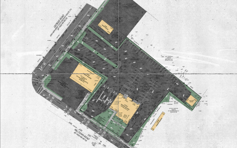
Types of Land Surveys

Boundary Surveys:
- These surveys involve meticulous measurement and documentation of property lines and corners, often referenced in legal deeds and documents.
- Utilizing advanced surveying techniques and equipment, boundary surveys establish the exact dimensions and boundaries of a property, ensuring accuracy in land ownership.
- They are essential for real estate transactions to prevent boundary disputes and legal conflicts, providing clarity and certainty to property owners and potential buyers.
- Boundary surveys may also reveal encroachments or unauthorized uses of land, helping to resolve conflicts and establish clear property rights.

Topographic Surveys:
- Topographic surveys provide detailed information about the terrain and features of a piece of land, including elevation, contours, vegetation, and man-made structures.
- Engineers rely on topographic surveys to understand the natural characteristics of a site, informing design decisions for grading, drainage, and construction projects.
- By capturing the existing conditions of the land, topographic surveys enable engineers to identify potential challenges and opportunities for development, ensuring efficient and sustainable project planning.
ALTA/NSPS Surveys:
- ALTA surveys adhere to standards set by the American Land Title Association (ALTA) and the National Society of Professional Surveyors (NSPS), providing comprehensive information for commercial real estate transactions.
- These surveys go beyond standard boundary surveys, offering detailed data on property boundaries, easements, rights-of-way, and other relevant features.
- ALTA/NSPS surveys are typically requested by lenders and investors during due diligence processes to assess the risks associated with a property and ensure compliance with title insurance requirements.
- They provide a comprehensive understanding of the property's legal and physical characteristics, minimizing uncertainty and potential liabilities for all parties involved in the transaction.

Construction Surveys:
- Construction surveys play a crucial role in ensuring that construction projects are executed accurately and according to design specifications.
- Surveyors work closely with construction teams to verify the location and elevation of structures, utilities, and infrastructure components during the construction process.
- By providing real-time feedback and verification, construction surveys help maintain alignment with project plans, minimize errors, and ensure quality control.
- Construction surveys are essential for achieving project timelines, avoiding costly rework, and ensuring compliance with regulatory requirements and safety standards.

Floodplain Surveys:
- Floodplain surveys assess and map areas prone to flooding, identifying flood hazards, floodplains, and floodways.
- They provide critical information for land use planning, zoning regulations, and flood risk management strategies.
- By understanding the extent and severity of flood risks, stakeholders can make informed decisions about development, infrastructure investments, and emergency preparedness measures.
- Floodplain surveys also play a crucial role in determining insurance requirements, evaluating property values, and protecting public safety and welfare in flood-prone regions.

Subdivision Surveys:
- Subdivision surveys are necessary when dividing a piece of land into smaller parcels or lots for development or sale.
- Surveyors ensure compliance with local zoning regulations, subdivision ordinances, and planning requirements when creating new property boundaries.
- These surveys facilitate the subdivision and development process, providing accurate measurements, legal descriptions, and plat maps for regulatory approval and recordation.
- Subdivision surveys also establish clear property rights and boundaries for individual lots, enabling efficient land use planning and development while preserving the integrity of surrounding properties.
.png)
Choosing the Right Survey for Your Project
Selecting the appropriate land survey involves a thoughtful assessment of several factors, including the project's size and nature, legal requirements, and available resources. It's also crucial to establish open channels of collaboration between civil engineers and surveying professionals, ensuring that the chosen survey meets both the technical and regulatory demands of the project.
Brigen Consulting recognizes that every outsourced civil engineering project is unique and requires a tailored approach to surveying. Our team of experienced professionals works alongside clients to identify the most suitable survey type to support the project's objectives.
Conclusion
The role of land surveys is unmatched in civil engineering. Every line on a blueprint, every well-planned route—its accuracy and soundness are rooted in the data captured during surveying. We, at Brigen Consulting, invite you to understand the complexities and significance of land surveys in your projects.
For expert advice and services in choosing and conducting the right land survey for your civil engineering endeavor, contact us. Our commitment to excellence and comprehensive understanding of surveying standards and regulations will offer you the guidance and support you need for a successful project.


